West Coast wildfire smoke stretches to Michigan in stunning satellite image
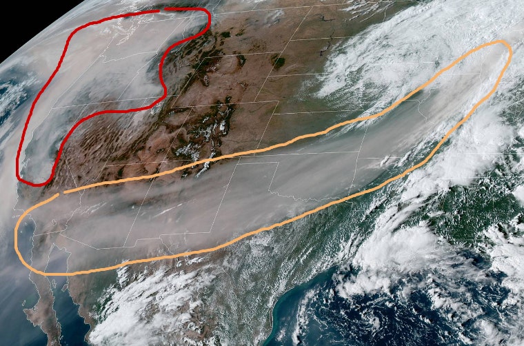
A vast pall of smoke from the West Coast wildfires has been captured in a remarkable satellite image. The image, tweeted by the National Weather Service Weather Prediction Center, shows smoke stretching as far east as Michigan. DEVASTATING WILDFIRE 'ANATOMY' EXPLAINED“Here is a visible satellite image valid at 2pm PDT showing the vast extent of the wildfire smoke,” the Weather Prediction Center tweeted Saturday. “The area in the orange contour is smoke in the mid-upper levels of the atmosphere that has reached as far east as Michigan! The red contour is the dense smoke near the West Coast.”Other satellite images have also shown the incredible scale of the wildfires.
Source: Fox News September 13, 2020 13:07 UTC