

Severe Weather Threat for Northeast Illinois, But Storm Track Appears to Be Crossing Southern Wisconsin
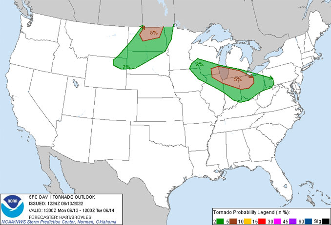
In other words, unless something develops fast, or the Wisconsin storms turn southeast, we’re going to see weak storms or scattered thundershowers in Chicagoland. According to the National Weather Service Storm Prediction Center, new storms will intensify by early afternoon over southern Wisconsin and northern Illinois and rapidly become severe. Northeast Illinois is an area where there is a 5% probability of a tornado within 25 miles of where a person is located, according to the National Weather Service Storm Prediction Center. The two areas of storms were initially consistent with prognostic storm tracks indicated by the National Weather Service Chicago office at 5:01 a.m. Monday morning. LAKE TEMPS …SOUTHERN LAKE MICHIGAN WATER TEMPERATURESNATIONAL WEATHER SERVICE CHICAGO/ROMEOVILLE IL900 AM CDT Mon Jun 13 2022LAKE MICHIGAN WATER TEMPERATURES…CHICAGO SHORE………56.
Source: ABC News June 13, 2022 17:43 UTC