


GPS data shows how quake warped NZ
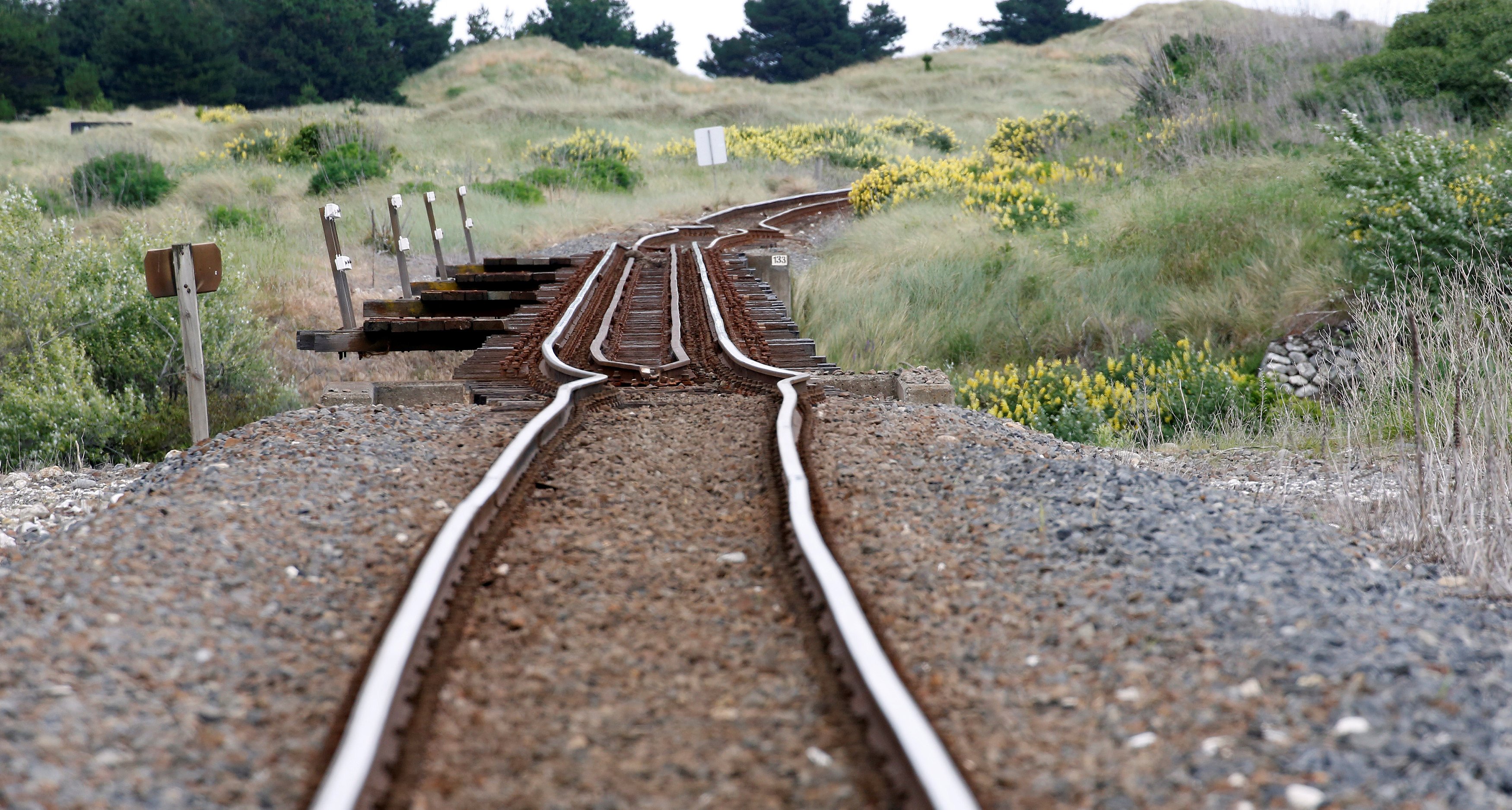
Scientists are trawling through data collected by hundreds of GPS markers scattered across the country to see how New Zealand has shifted following the latest quake. A railway line south of Blenheim shows the force of Monday's quake. Photo: ReutersGNS Science regularly draws data from around 900 marker sites across the country, with 150 markers also streaming GPS locations to GeoNet monitors. Scientists had been able to use the GPS data to simulate the country's distortion over a four-million-year period without allowing for earthquake impacts. It projected much of the South Island and the lower North Island slimming into a skinnier tract of land, while the North Island rotates around and both islands grow closer together.
Source: Otago Daily Times November 14, 2016 05:55 UTC


